What is a USGS 7.5 Minute Quad Topo Map and how do you read one?
USGS 7.5-Minute Topo Maps: Your precise guide for outdoor exploration, showcasing elevation changes, landmarks, and terrain insights across 49 sq. miles. No tech needed!
Have you ever wondered how people travel across vast areas of land without the help of technology such as GPS or smartphones? The USGS Quadrangle Topographic Map holds the answer. Adventurers, hikers, geographers, and explorers in the US have relied on these maps for decades.
The United States Geological Survey (USGS) creates The USGS Topographic Maps. There are different types of Topo maps including USGS 7.5-Minute Quad, 15-Minute Quad, 30-Minute Quad, 1:24,000 Scale, 1:100,000 Scale, digital, geological, and many more. However, in this blog, we will concentrate on the most commonly used topographic map in the United States, which is the USGS 7.5-Minute Quad Topo Map. We will learn about the USGS 7.5-Minute Quad Topo Map and its importance in understanding our natural surroundings and delve into the details by providing elaboration and examples.
What are USGS 7.5-Minute Quadrangle Maps?
The USGS 7.5-Minute Quad Topo Map captures an area of approximately 7.5 minutes of latitude and longitude, covering about 49 square miles. Each map is a treasure trove of information, presenting intricate details of the terrain, such as elevation changes, contour lines, rivers, roads, and landmarks. This level of precision enables adventurers and outdoor enthusiasts to confidently plan and navigate their journeys without relying on modern electronic devices. These maps can provide valuable insights into the lay of the land, identifying potential challenges and opportunities along the way.
Features of USGS 7.5-Minute Quad Topo Maps
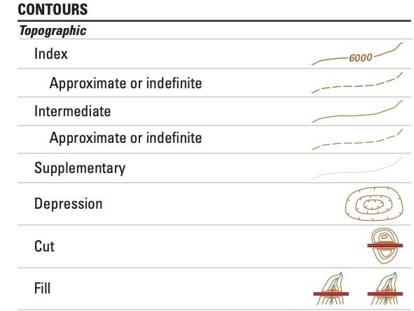
1. Contour Lines: The primary feature of these maps is the contour lines, which represent elevation. By studying the contour lines on a map, you can visualise the shape of the land, identify mountains, valleys, and ridges, and understand how steep or gradual the terrain is.
Imagine you're planning a hiking trip in the mountains and want to rely less on technology. A Topo map, which depicts contour lines forming concentric circles around the mountain's summit, becomes your trusty guide. Closer lines indicate steeper slopes, assisting you in anticipating terrain difficulty and locating ideal locations for hiking, skiing, or mountaineering adventures.
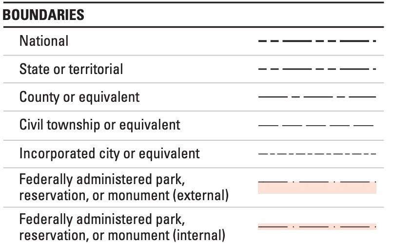
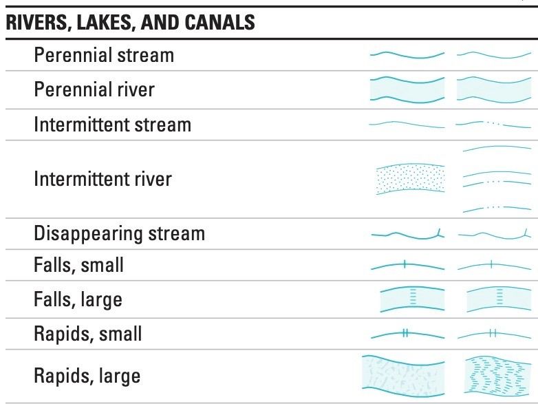
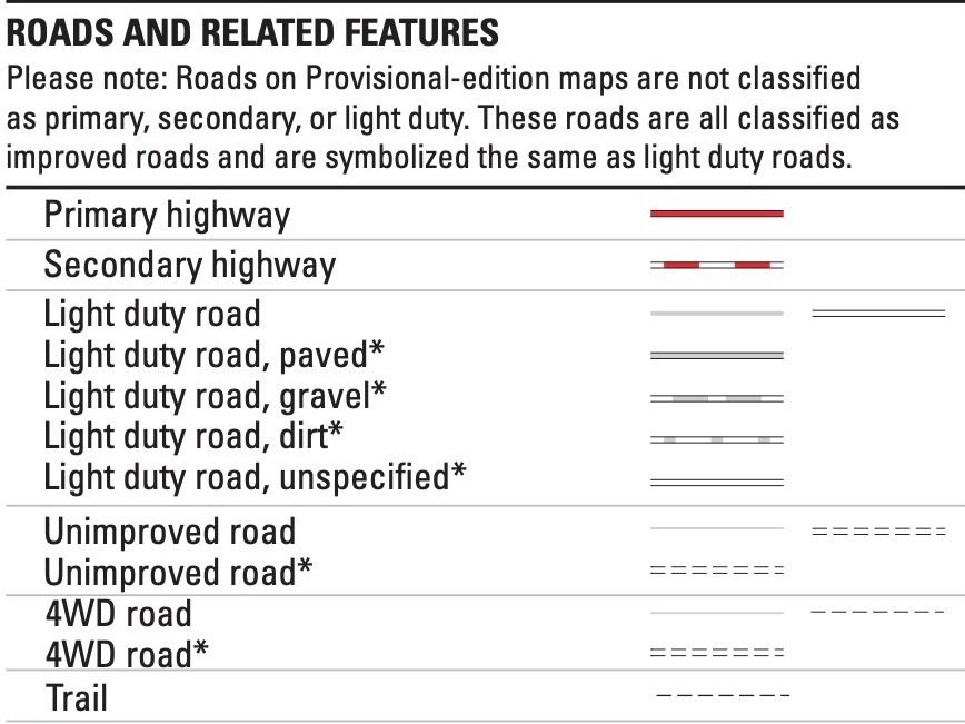
2. Symbols: Rivers, roads, buildings, vegetation, and cultural landmarks are represented through unique symbols. A wavy blue line, for example, represents a river, whereas a dotted line represents a trail or footpath. Building symbols can range from simple geometric shapes to more detailed illustrations that state the importance or function of the structure.
3. Scale and Distance: Topo maps have a scale that indicates the ratio of distance on the map to the actual distance on the ground. It helps you estimate distances between points and plan your journeys more accurately. For instance, a scale of 1:24,000 means that one inch on the map represents 24,000 inches or 2,000 feet on the ground.
Let's say you're organising a hiking trip and want to calculate the distance between two campgrounds. You can use the scale on the topo map to assess the distance between the two points and whether it is a manageable hike for your timeframe.
4. Coordinates: The maps include latitude and longitude markings, which enable precise location identification. These coordinates can be used with a compass or GPS device to determine your position on the map and navigate your surroundings effectively.
For example, if you find yourself at a specific latitude and longitude coordinates, you can pinpoint your exact location on the map and plan your next move accordingly.
5. Legend: Each map includes a legend that explains the symbols, colours, and other map features used. Legend is your guide to interpreting the map accurately and understanding the information it provides.
Identifying Common Topographical Map Symbols
To fully utilise the wealth of information provided by USGS 7.5-Minute Quad Topo Maps, it is essential to familiarise yourself with common symbols used on these maps. Here are some frequently encountered symbols and their meanings.
1. Blue Lines: Represent water features such as rivers, streams, lakes, and ponds. The thickness of the lines may indicate the size or importance of the water body.
2. Roads and Trails: Different types of roads and trails are typically indicated by varying symbols. Highways are represented by thick, solid lines, while smaller roads are depicted with narrower lines. Dotted or dashed lines often represent trails, footpaths, or routes.
3. Buildings: Structures like houses, schools, churches, and other significant buildings are usually depicted as simple geometric shapes, with variations in size and style indicating their relative importance.
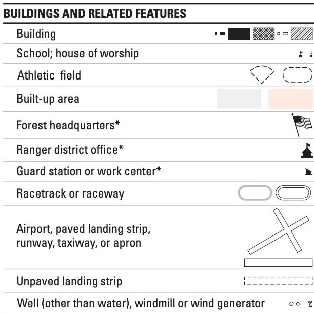
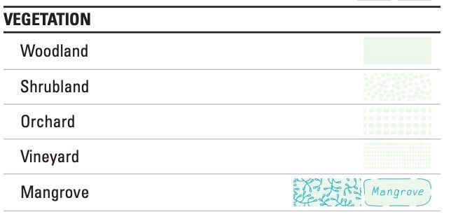
4. Vegetation: Symbols are used to represent different types of vegetation, such as forests, orchards, or vineyards. These symbols help identify areas with dense tree cover or specific types of flora.
5. Brown Contour Lines: These lines depict elevation changes and represent the shape of the land. The closer the lines are together, the steeper the slope. A closed loop of contour lines indicates a hill or a mountain.
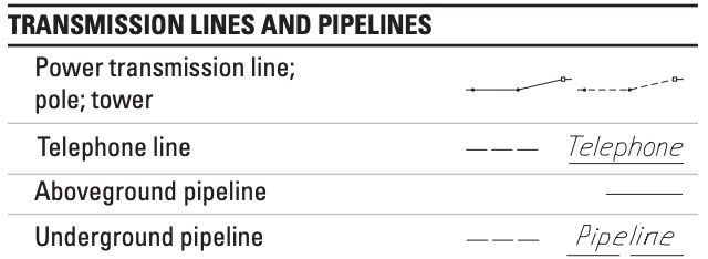
6. Man-made Features: Various human-made structures like power lines, bridges, dams, and campsites are denoted by specific symbols. These symbols assist in identifying key points of interest or potential obstacles.
7. Contour Interval: A number indicating the vertical distance between adjacent contour lines is often displayed on the map. This interval assists in understanding the scale of elevation changes and provides valuable insights into the landscape's ruggedness.
Importance and Applications
The USGS 7.5-Minute Quadrangle Topographic Maps serve a wide range of purposes, including:
1. Outdoor Recreation: Whether you are hiking, camping, fishing, or hunting, topo maps are invaluable for planning routes, understanding the terrain, and identifying landmarks. For example, when hiking in mountainous regions, a topo map helps you choose the best path, avoid treacherous areas, and locate water sources along the way.
2. Land Management: These maps assist land managers, foresters, and conservationists in understanding and protecting natural resources, managing forests, and planning infrastructure projects. For instance, land managers can use Topo maps to identify areas of ecological importance or plan the placement of trails and facilities while minimising environmental impact.
3. Geological Studies: Geologists use Topo maps to study the Earth's surface, identify geological formations, and understand how landscapes evolve. By analysing the patterns of contour lines, geologists can uncover the history of rock formations, map fault lines, and identify potential mineral deposits.
4. Emergency Preparedness: Topo maps are crucial tools during emergencies and natural disasters. They help first responders and emergency management teams navigate affected areas, locate resources, and plan evacuation routes. In scenarios such as wildfires or floods, Topo maps assist in identifying safe routes and potential hazards.
Beyond being a conventional navigational tool, the USGS 7.5-Minute Quad Topo Maps hold a wealth of invaluable information about our natural environment. These maps provide a new level of depth and insight through detailed elevation data, landmarks, and geographical features, allowing us to explore, understand, and truly appreciate the world around us.
Recently, Clockwork introduced its USGS 7.5-minute Topo Quad Map page, offering an extensive collection of 53,000 USGS Topo quads available for effortless download. With a user-friendly interface, no registrations or sign-ups are required – obtaining your desired quad is as simple as 1-2-3:
- Zoom in on the map or use the search bar.
- Locate the desired quad.
- Download the PDF version.
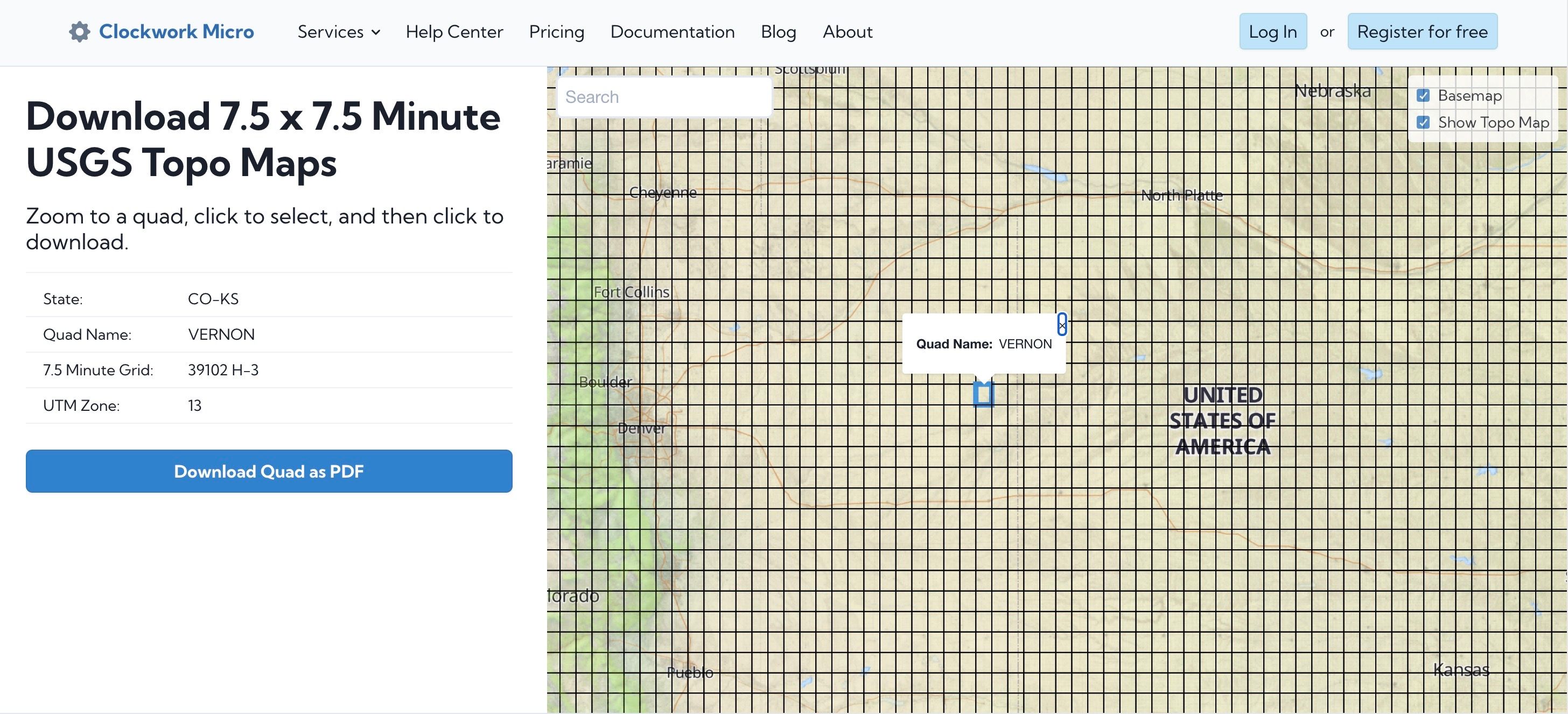
At Clockwork Micro, we specialize in managing the backend mapping infrastructure, ensuring the smooth tiling, maintenance, and updates for USGS Topo maps. So why wait? Download your USGS 7.5-minute Topo Quad Map now and explore the wonders of the great outdoors with confidence!